The Feather River runs from the Sierra crest down to Lake Oroville and on past Oroville into the valley. Highway 70 follows it through the canyon as the Feather River Scenic Byway, 130 miles long with no fee; the Federal Highway Administration says to allow about three hours to drive it. Below the dam, the CDFW Oroville Wildlife Area lines the river.
Checked October 29, 2026
- 130 miFeather River Scenic Byway
- 3 hrstime to allow, per FHWA
- 11,800acres, Oroville Wildlife Area
- $31a night at the canyon campgrounds (2026)
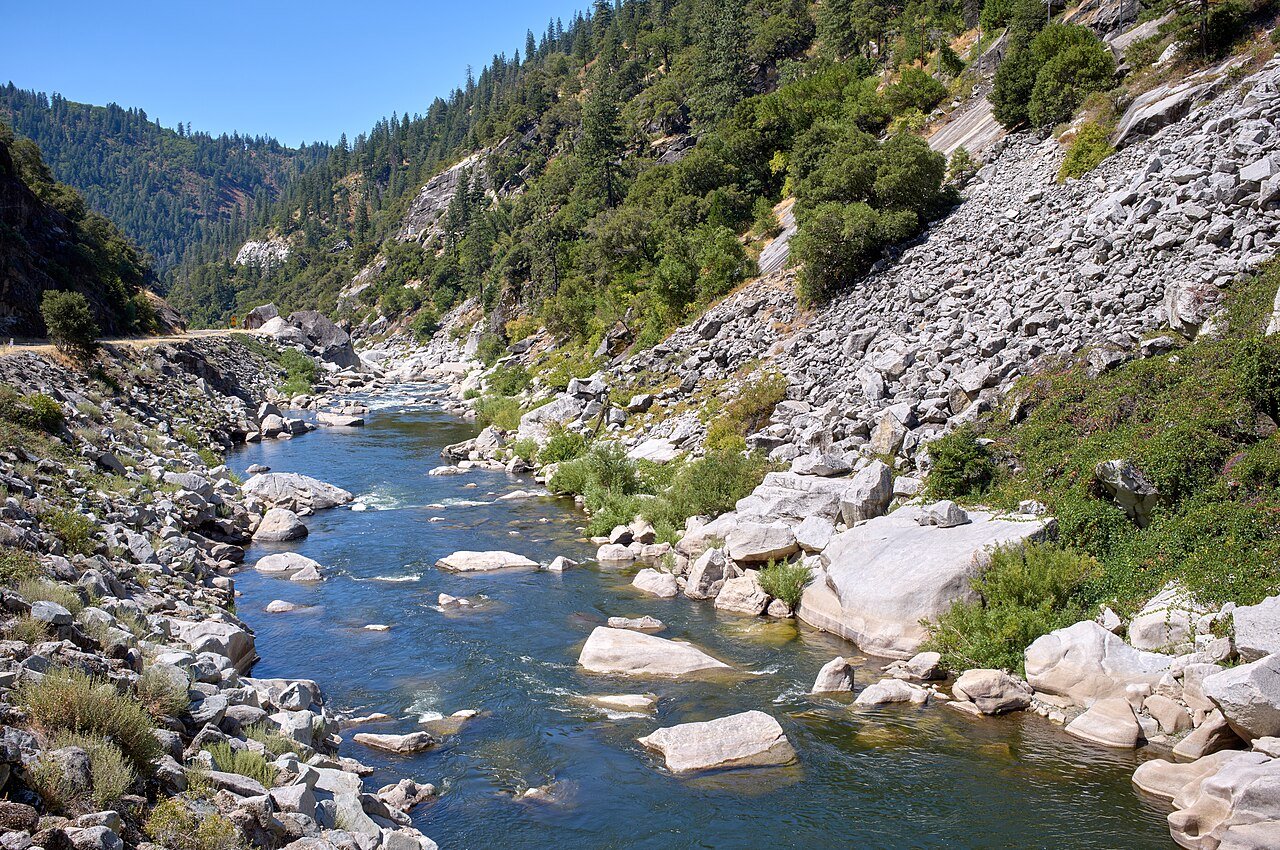
Driving The Canyon on Highway 70
The byway climbs over the Sierra crest at Beckwourth Pass and is known for its covered bridges and railroad history, the FHWA byway page says. It passes through Plumas National Forest, which covers 1,146,000 acres of the northern Sierra Nevada; the forest contact listed is 530-283-2050. For road conditions, Caltrans points to its QuickMap and the 1-800-427-7623 line.
Our one-day loop from Chico up the canyon to Lake Almanor and back is here: Feather River to Lake Almanor Drive.
Campgrounds on The North Fork
| Campground | Sites | Fee | Season (2026) |
|---|---|---|---|
| Gansner Bar | 17 | $31 a night | Closed for the season September 27 |
| North Fork | 21, with showers, hookups and a dump station | See the Forest page | Closed for the season September 27 |
| Queen Lily | 12 | $31 a night (Recreation.gov) | Services mid-May to late September |
All three sit on the North Fork Feather River off Caribou Road, about 2 to 2.5 miles north of Highway 70 and about 30 to 32 miles west of Quincy.
Oroville Wildlife Area
CDFW describes the Oroville Wildlife Area as about 11,800 acres, mostly riverside woodland along the Feather River plus grassland around the Thermalito Afterbay. Warm-water fish there include largemouth bass, bluegill, green sunfish, channel catfish and black crappie. CDFW posts that the Afterbay Outlet boat ramp and campground are closed, with public access prohibited, until summer 2027.
Fishing Rules
The Feather River has its own rules in the CDFW freshwater sport fishing regulations, linked from wildlife.ca.gov/Regulations along with an interactive map. Read the section for the stretch you plan to fish. The salmon and steelhead story starts at the hatchery in Oroville; see the Lake Oroville guide.
Area guide: Lake Almanor & The Feather River, Oroville & Lake Oroville.
Map of The Feather River
Coming Up Along The Feather River
Nothing on our calendar for Lake Almanor & The Feather River from today on yet. We only list a date once we have read it on the organizer’s own page, so here is what comes next. See every upcoming event.
Annual Corning Trick or Treat Street
2:00 PM to 5:00 PM
Citywide, Corning
Price: Free
Trick-or-treating at more than 100 Corning businesses, with pumpkin judging and a Costumed Dog Parade at 5:30 PM.
Checked Oct 29, 2026 · Source for Annual Corning Trick or Treat Street (opens in a new tab)Treat Street
2:00 PM to 6:00 PM
Downtown Chico
Price: See event page
Families trick-or-treat at downtown businesses, with live music, a 4:00 PM costume contest and street closures. Free downtown parking 2:00 to 6:00 PM.
Checked Oct 29, 2026 · Source for Treat Street (opens in a new tab)October Movies in The Park: Hocus Pocus 2
5:00 PM to 9:00 PM
DeGarmo Park, Chico
Price: Free
Halloween movie night with a costume parade at 6:15 PM, food trucks and free popcorn; the film starts at dusk. Bring blankets and lawn chairs.
Checked Oct 29, 2026 · Source for October Movies in the Park: Hocus Pocus 2 (opens in a new tab)
What We Could Not Verify
- The Forest Service byway page returned “page not found”, so the byway facts come from the FHWA byway page.
- Whether PG&E runs any campgrounds on the North Fork Feather. Not confirmed
- Oroville Wildlife Area hours: the CDFW page gives both “sunrise to sunset” and 1.5 hours before sunrise to 1 hour after sunset, and its Lands Pass line names Gray Lodge. Not confirmed
- 2027 campground opening dates are not posted yet. Not confirmed
Questions People Ask
How long does it take to drive the Feather River Scenic Byway?
The FHWA byway page says to allow three hours for the 130 miles, with no fee to drive it.
Are the canyon campgrounds open now?
Gansner Bar, North Fork and Queen Lily closed for the 2026 season on September 27. Services generally run mid-May to late September.
Where do I check Highway 70 conditions?
Caltrans QuickMap, or the Caltrans line at 1-800-427-7623.
Place Pages for This Guide
More Guides
- Bidwell Park
- Lake Oroville
- Feather River
- Lake Almanor
- Birding & Snow Geese
- Chico State
- Breweries (21+)
- Farm Country
- Swimming & Floats
- Almond Bloom & Fall Color
- All Guides
Sources
- FHWA, Feather River Scenic Byway: https://fhwaapps.fhwa.dot.gov/bywaysp/byway/2196 (checked October 29, 2026)
- USDA Forest Service, Plumas National Forest: https://www.fs.usda.gov/plumas (checked October 29, 2026)
- Plumas NF, Gansner Bar Campground: https://www.fs.usda.gov/r05/plumas/recreation/gansner-bar-campground (checked October 29, 2026)
- Plumas NF, North Fork Campground: https://www.fs.usda.gov/r05/plumas/recreation/north-fork-campground (checked October 29, 2026)
- Plumas NF, Queen Lily Campground: https://www.fs.usda.gov/r05/plumas/recreation/queen-lily-campground (checked October 29, 2026)
- Caltrans, roads: https://roads.dot.ca.gov/ (checked October 29, 2026)
- CDFW, Oroville Wildlife Area: https://wildlife.ca.gov/Lands/Places-to-Visit/Oroville-WA (checked October 29, 2026)
- CDFW, Regulations: https://wildlife.ca.gov/Regulations (checked October 29, 2026)
Cite this page: It's Chico, “Feather River Guide: Canyon Drive, Camping and Fishing”, itschico.com/guides/feather-river/ (updated ). By the It's Chico editorial team. Free to quote with attribution and a link to this page; data and tables are licensed CC BY 4.0.